

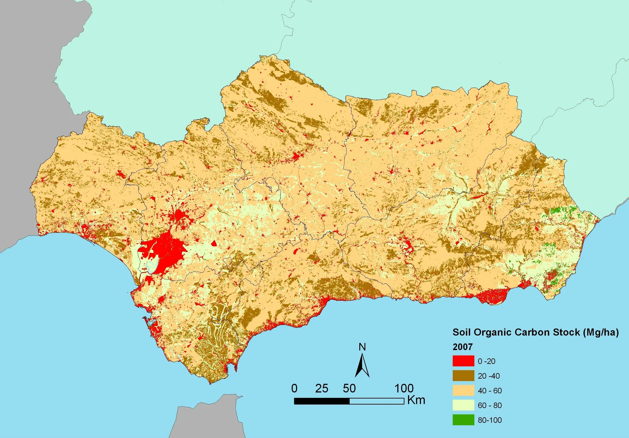
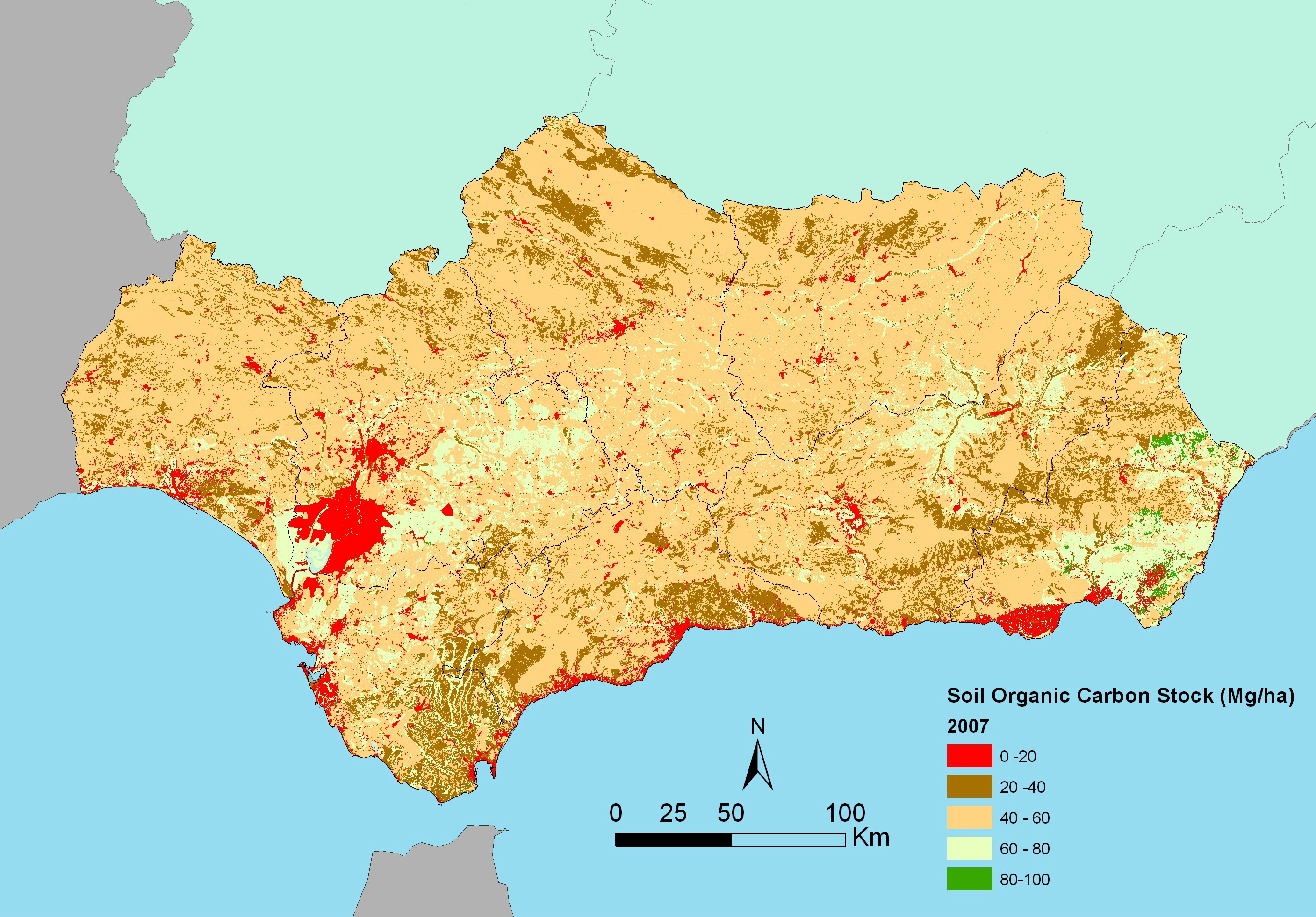
Map of soil organic carbon content (0–75 cm) in Andalusia (southern Spain)

Antonio Jordán
University of Seville, Sevilla, Spain
This image is part of the results by Muñoz-Rojas et al. (2012). For this map we used soil information from different databases, as well as land use digital maps, climate databases and digital elevation models. Average soil organic carbon stocks were calculated for each combination of soil and land use type.
Published paper: Muñoz-Rojas, M., Jordán, A., Zavala, L. M., De la Rosa, D., Abd-Elmabod, S. K., and Anaya-Romero, M. 2012. Organic carbon stocks in Mediterranean soil types under different land uses (Southern Spain), Solid Earth, 3, 375-386. DOI: http://dx.doi.org/10.5194/se-3-375-2012.
Category
Tags
Reuse
Creative Commons Attribution 3.0 Unported (CC BY 3.0) (opens in a new window)Credit: Antonio Jordán (distributed via imaggeo.egu.eu)
Properties
Type
Image
Format
JPG
Size
1.4 MB
Aspect
2815:1963
Width
2815 px
Height
1963 px
Coordinates
37.5443, -4.7278
Tint
Very light greenish blue
Published
6 November 2015
Comments
No comments yet. Be the first to share your thoughts.