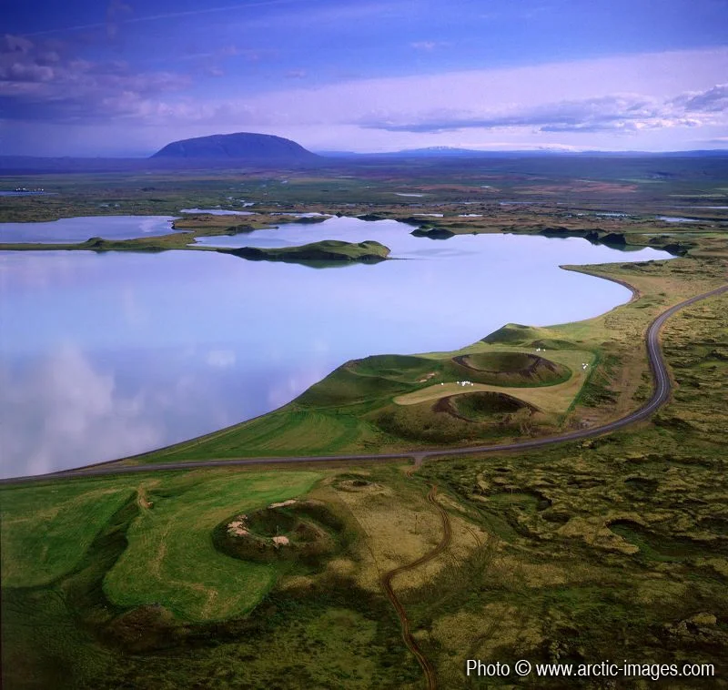
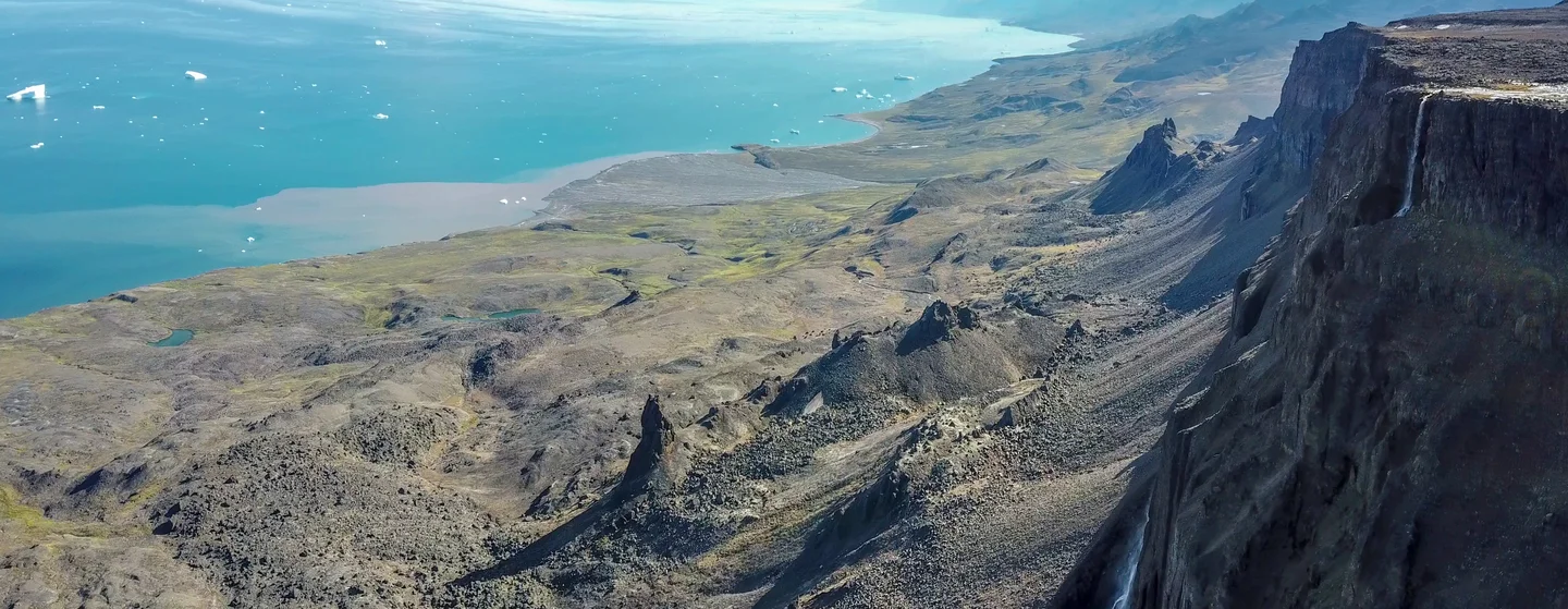
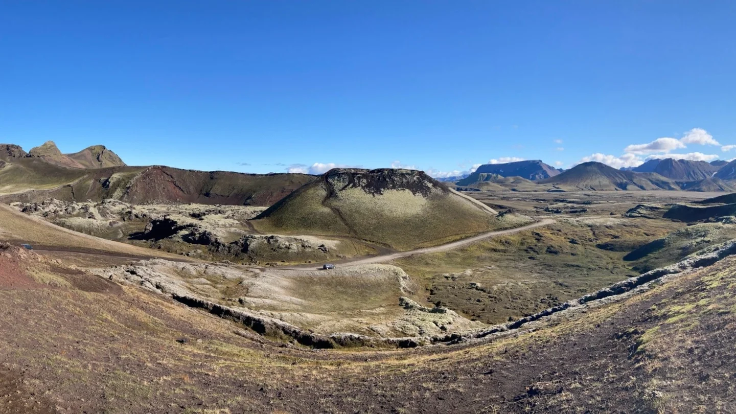
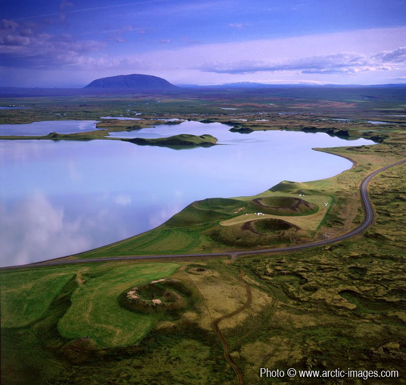
Aerial of Lake Myvatn, Northern Iceland
Lake Myvatn was created by a large basaltic lava eruption 2300 years ago, and the surrounding landscape is dominated by volcanic landforms, including lava pillars and rootless vents known as pseudocraters. Higher resolution images available from rth@arctic-images.com. There is a licensing fee depending on the use of the image.
Reuse
Creative Commons Attribution-NonCommercial-ShareAlike 3.0 Unported (CC BY-NC-SA 3.0) (opens in a new window)Credit: Ragnar Sigurdsson (arctic-images.com) (distributed via imaggeo.egu.eu)
Properties
Type
Image
Format
JPG
Size
181.7 KB
Width
800 px
Height
758 px
Aspect
400:379
Coordinates
65.5857, -16.9941
Tint
Dark olive
Submitted
10 January 2010
Comments
No comments yet. Be the first to share your thoughts.