

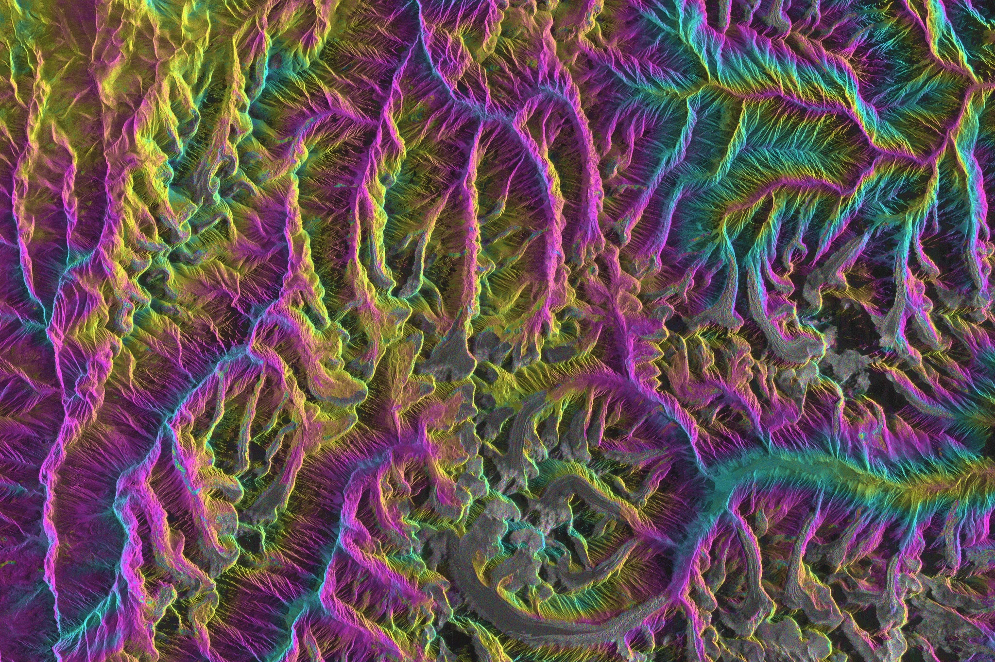
Among the Artefacts of Atmosphere

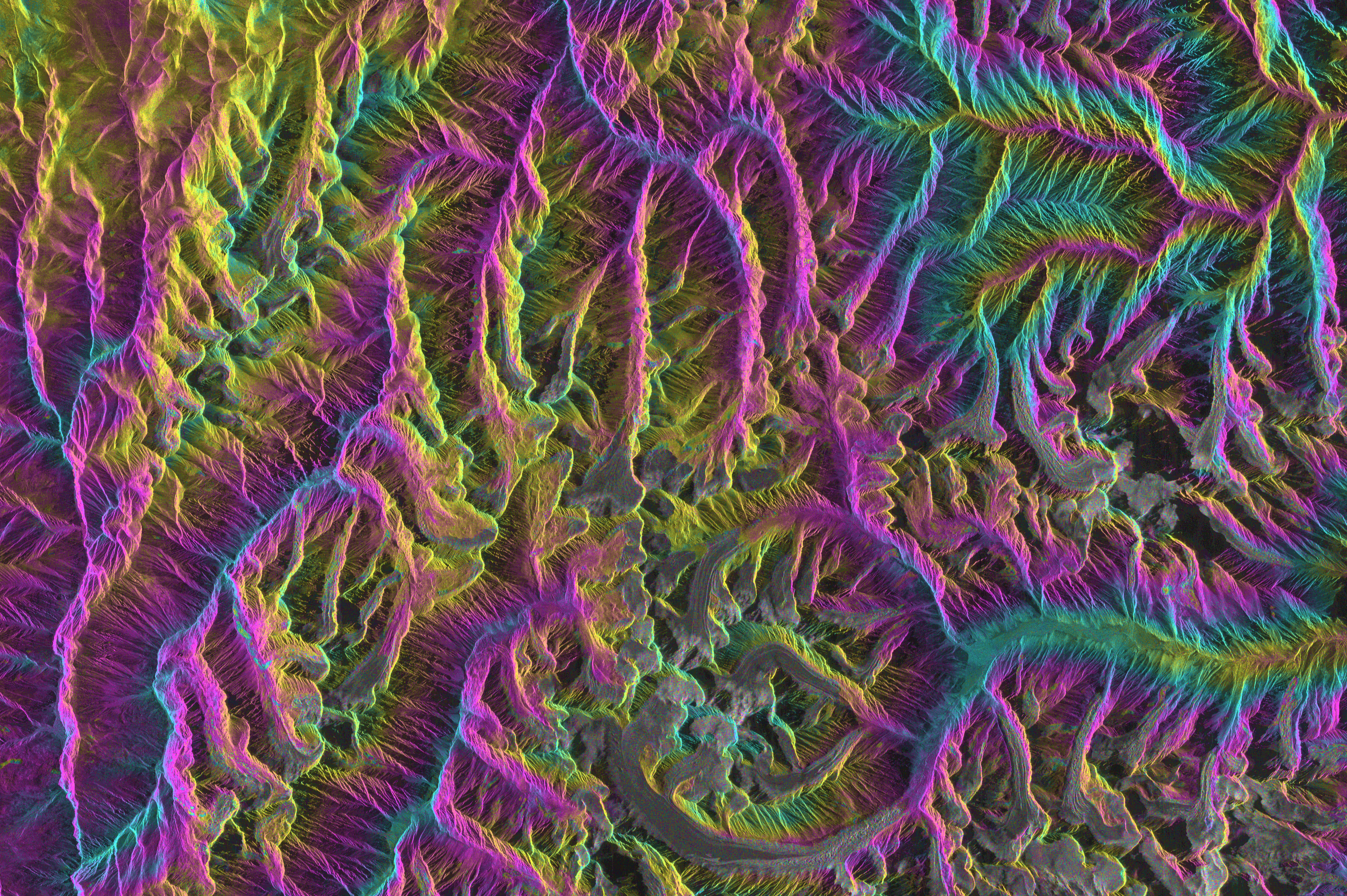
This image showcases both the power and beauty of Differential Interferometric Synthetic Aperture Radar (D-InSAR), as well as the challenges it faces in measuring surface changes occurring in steep mountain areas (Uttarakhand, Indian Himalayas). Radar sensors mounted on satellites send microwaves to the ground, enabling the detection of ground displacements with subcentimetric accuracy. Among the beautiful phase gradient following the region's elevation, this image features a multitude of detected mass movements. D-InSAR helps us study Earth's surface deformation even in inaccessible areas. We benefit from this technology in investigating geophysical processes and natural hazards such as earthquakes, active volcanism, glacier dynamics, and landslides.
Authors: Gwendolyn Dasser and Andrea Manconi. Image contains modified Copernicus Sentinel data 2020.
Finalist in the EGU Photo Competition 2025
Category
Location
Reuse
Creative Commons Attribution-NonCommercial-NoDerivs 3.0 Unported (CC BY-NC-ND 3.0) (opens in a new window)Credit: Gwendolyn Dasser (distributed via imaggeo.egu.eu)




Comments
No comments yet. Be the first to share your thoughts.