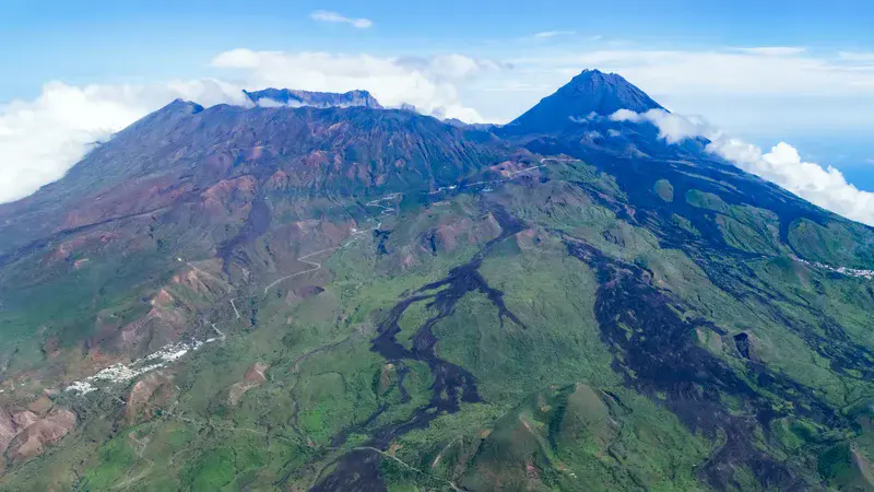
Cape Verde | Island of Fogo with Pico do Fogo
by Martin Mergili, University of Graz, Graz, Austria
Flight São Filipe - Praia, view to the S slopes of the volcanic island of Fogo with the village of Achada Fuma shown on the left side. Lava flows stand in sharp contrast to the otherwise green landscape during the wet season. The former island summit (Monte Amarelo) collapsed into the sea in prehistoric times, leaving behind the escarpment of the Bordeira (upper left portion of the picture). The summit cone Pico do Fogo (2829 m) in the right central background formed afterwards.
Categories
- Geochemistry, Mineralogy, Petrology & Volcanology (990)
- Geomorphology (1404)
- Interdisciplinary/Other (841)
- Natural Hazards (526)
Location
- Africa (373)
- Western Africa (25)
- Cape Verde (6)
- Exact location (-24.3431 W, 14.9017 N)
Tags
- volcano (196)
- stratovolcano (7)
- lava flow (22)
- volcanic landscape (32)
- volcanic island (2)
- cloudscape (6)
- aerial view (1)
Colours
Image properties
4864 × 2736 px;
image/jpeg; 11.5 MB
Camera:
Canon EOS 7D
Software: Adobe Lightroom, Adobe Photoshop, GIMP, Irfan View
Taken on 10
September
2022
Submitted on 31 March 2023
Licence
Creative Commons Attribution 3.0 Unported (CC BY 3.0)
Credit
Martin Mergili (distributed via imaggeo.egu.eu)
Share
Appreciate
Report