
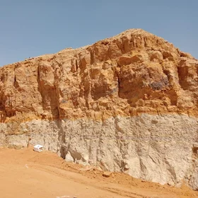
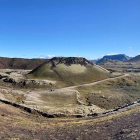
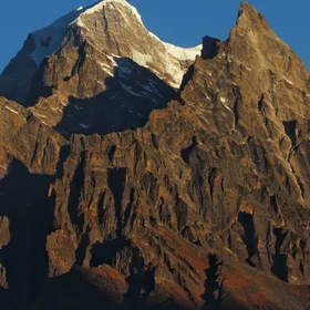
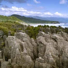
Bolivian tectonic landscapes in ToroToro National Park
This photo was taken in 2018 when I was doing a field trip in Toro Toro National Park, exploring the Cretaceous-Paleogene (KT) boundary with my fellow colleagues from Mayor de San Andres University, from La Paz-Bolivia. Toro Toro National Park, located in the Province Charcas, North of Potosí Department, Bolivia, presents itself as a geological, biological, and anthropological singularity and brings one of the most integrated and complete sedimentary records in the world. During the Upper Cretaceous, the elevation of the sea level led to a marine transgression of this basin. The epicontinental shallow sea, with several carbonate environments and a diversity of marine trophic chain species, from microbial, molluscs, even fish and turtles, was registered by abundant fossil and fifth and sixth order stratigraphic sequences, recorded by El Molino Formation. On the shore of this sea, different groups of dinosaurs wandered, and the tracks and footprints were preserved. Due to these worldwide known ichnites, Toro Toro was registered as a Global Geological Site by UNESCO under the number 189 in the year 1986. More than 2,500 tracks of five groups of dinosaurs in various combinations of footprints are estimated. Toro Toro dinosaur tracks have already been considered as a very diverse set, not recorded anywhere in the world.
Categories
Reuse
Creative Commons Attribution-ShareAlike 3.0 Unported (CC BY-SA 3.0) (opens in a new window)Credit: Grisel Jimenez Soto (distributed via imaggeo.egu.eu)

Comments
No comments yet. Be the first to share your thoughts.