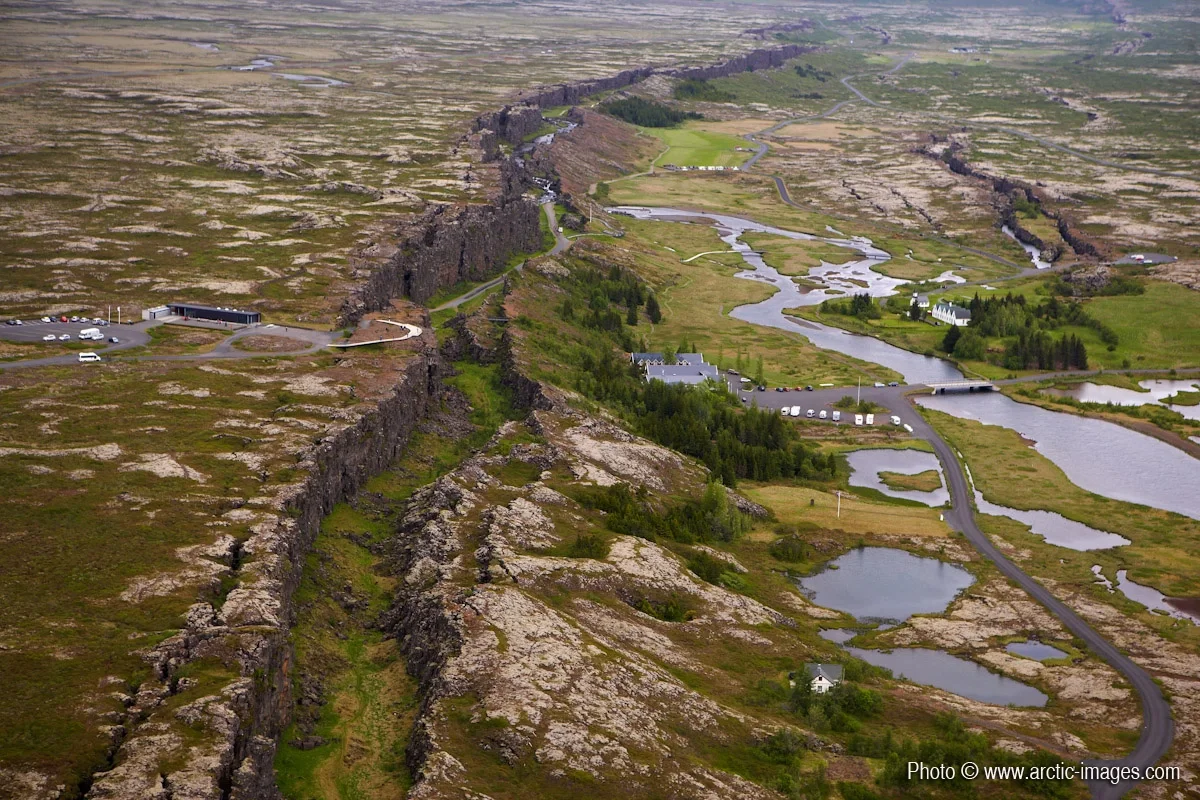
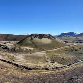
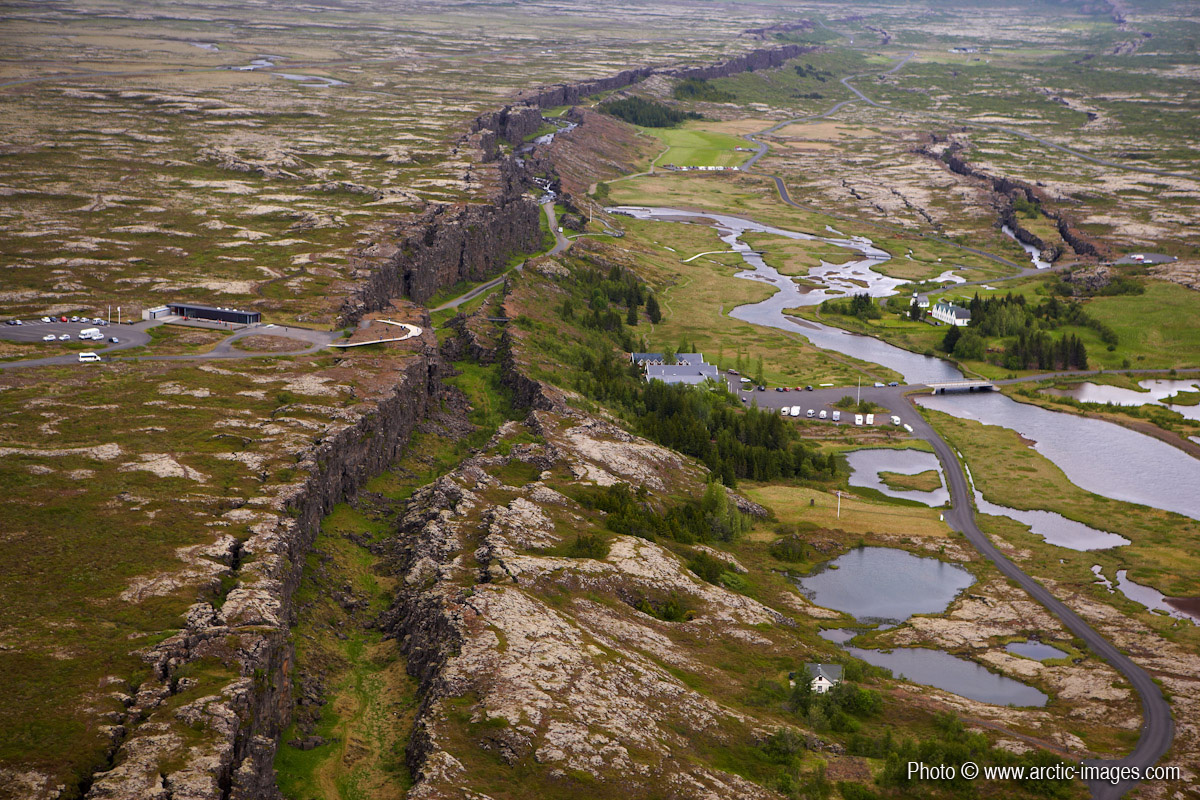
Aerial of Almannagja fissure, Thingvellir National Park, Iceland
Almannagja- 7.7 km long, width 64 m, maximum throw is 30-40 m. It marks the eastern boundary of the North American plate. Its equivalent across the graben, marking the western boundary of the Eurasian plate is Hrafnagja. It is 11 km long, 68 m wide and a maximum throw of 30 m. Thingvellir is also renowned for its geological significance. The area is located on the Mid-Atlantic ridge, where the continents of Europe and America drift apart, causing earthquakes and volcanic activity. Standing in the Almannagja fissure, the visitor is literally situated between the continental plates. Higher resolution images available from rth@arctic-images.com (there is a licensing fee depending on the use).
Properties
Licence
Credit
Ragnar Sigurdsson (arctic-images.com) (distributed via imaggeo.egu.eu)


Comments
No comments yet. Be the first to share your thoughts.