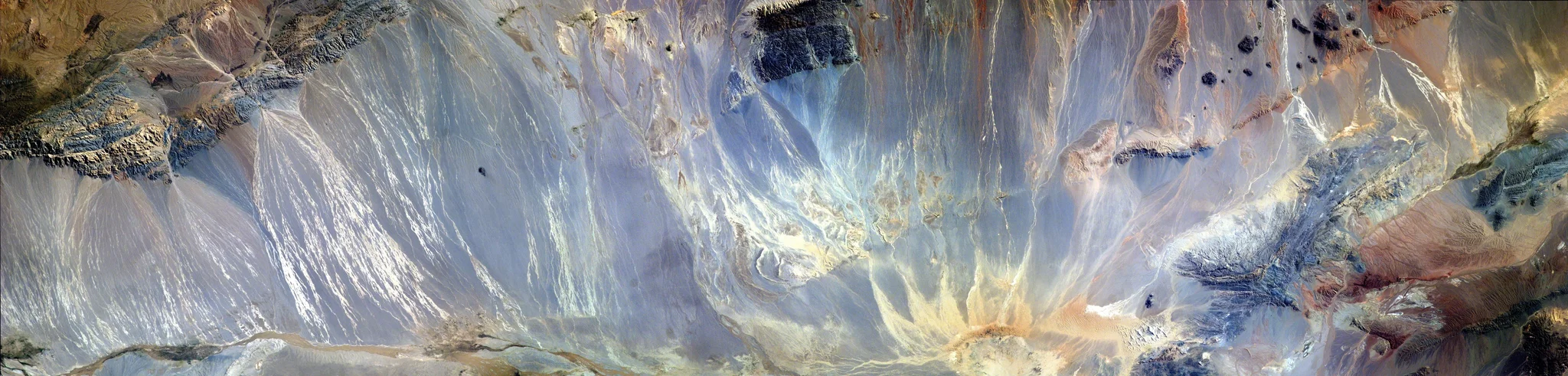
Mountains, ice and sand frozen in time
The photo is a panorama realized from 3 photos taken from the International Space Station (ISS), approx. 400 km above the Earth, in the educational project, administered by NASA: Sally Ride EarthKAM , Mission 53, 12-15 July 2016. All 3 images were requested by a team of students from my college, coordinated by me. Even though we weren't there, on ISS, to trigger the camera, all the locations in which the photographs were taken are chosen by us, on the track of the ISS. The lenses used on the digital camera mounted on the ISS are 180 mm focal length. The area photographed in the panorama is a rectangular zone of 37.31 km wide and approx. 150 km long, from Mongolia, Asia. Satellite photography offered to my students a new perspective of the world, encouraging them to ask questions and to search for the answers. It is a new way to travel and to discover the world around us in a new and exciting way.
Properties
Credit
Diana Bejan (distributed via imaggeo.egu.eu)

Comments
No comments yet. Be the first to share your thoughts.