
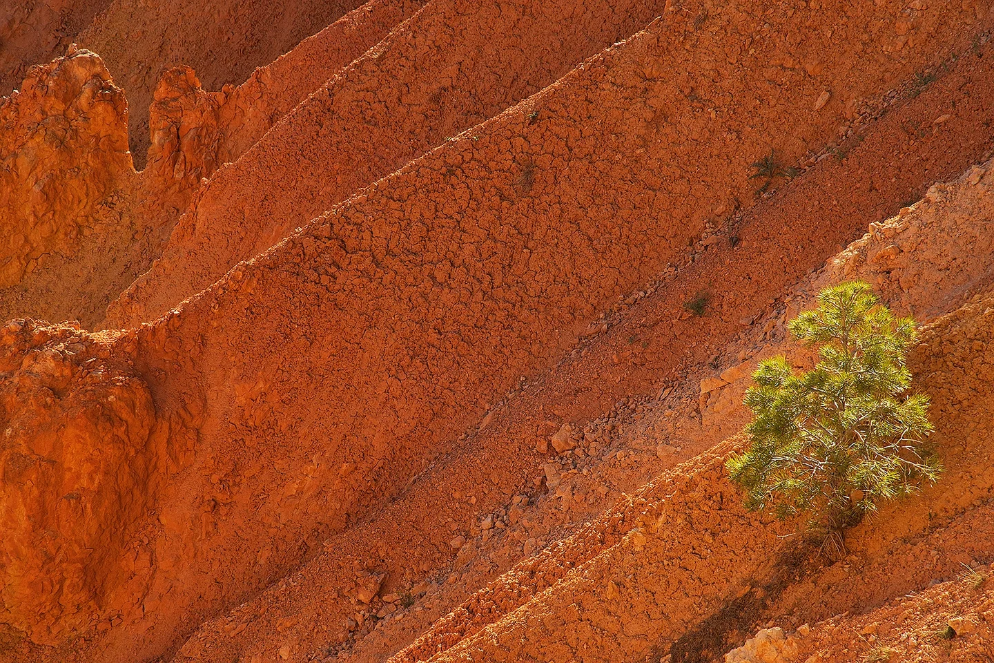
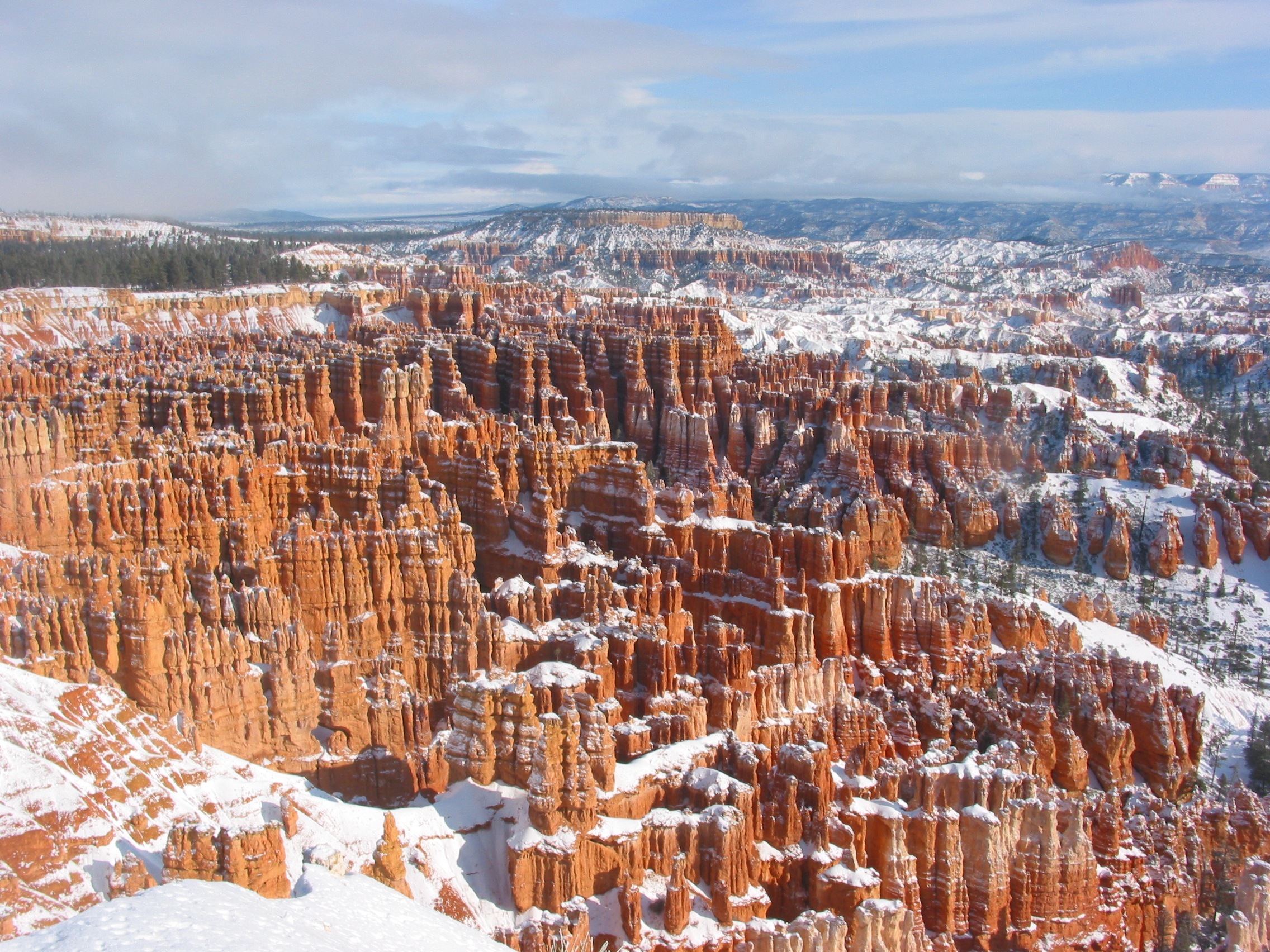
Bryce Canyon in winter
Bryce Canyon offers one of the most spectacular settings to explore the erosion of an uplifted sedimentary basin. Here the Earth's activity is shown in many ways: erosion of a former orogen resulted in the formation of thick sedimentary units. These rocks were uplifted again by tectonic movements and the subsequent incision of the Colorado initiated regressive erosion that nowadays can be seen at Bryce Canyon. This process is being fed by atmospheric processes whereby overland flow generated by intensive rainstorms erode the area at rates of up to 10 mm/year. Water erosion is facilitated by the frost-thaw weathering of the soft sedimentary rocks. The Bryce Canyon plateau is situated well above 2500 m and temperatures can fall below 0°C (the day the picture was taken, temperatures did not rise above -10°C). Melting of snow and infiltration of water into the cracks generated by freeze-thaw further degrade the stability of the rocks.
Categories
Tags
Reuse
Creative Commons Attribution-ShareAlike 3.0 Unported (CC BY-SA 3.0) (opens in a new window)Credit: Gert Verstraeten (distributed via imaggeo.egu.eu)

Comments
No comments yet. Be the first to share your thoughts.