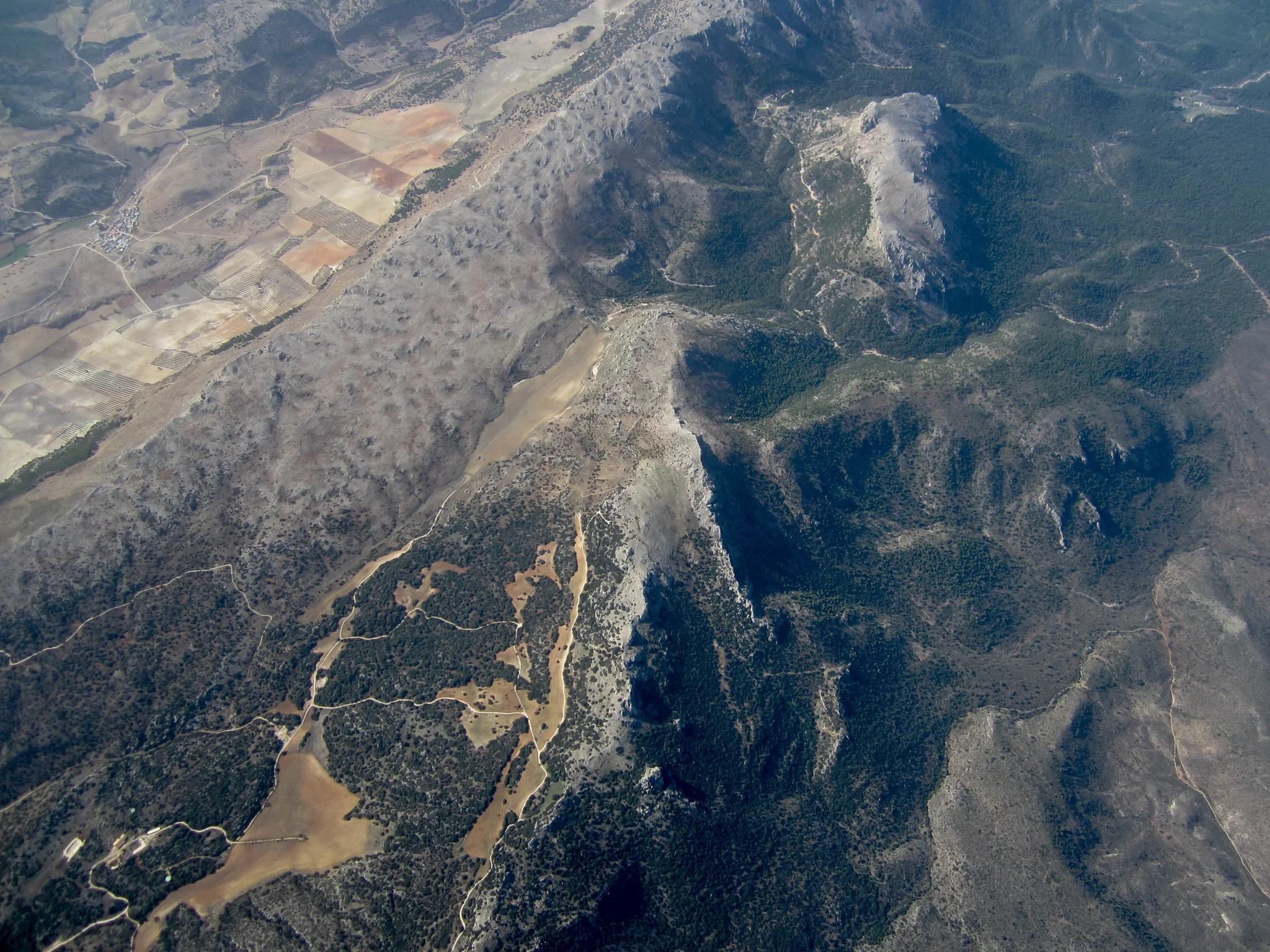
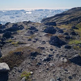
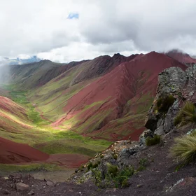
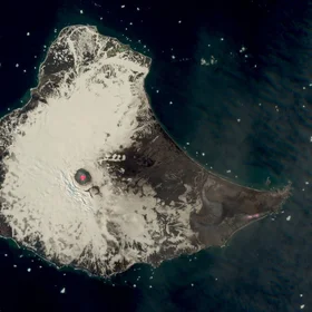
Sierra Arana sinkholes cartography (Granada, Spain)
This picture was taken at an altitude of about 6000m by a balloon-based UAV called "Stratochip". The Stratochip is fully autonomous and can travel tens to hundredths of miles while taking pictures of the ground from different angles, with its orientable camera. This flight aimed at the cartography (orthomosaics and DEM reconstruction by Structure-from-Motion) of a karstic field (sinkholes in the upper-left side of the picture) forming in the Jurassic carbonates formations of the Sierra Arana mountain range, Granada region.
Categories
Reuse
Creative Commons Attribution-ShareAlike 3.0 Unported (CC BY-SA 3.0) (opens in a new window)Credit: Christian Burlet (distributed via imaggeo.egu.eu)
Properties
Type
Image
Format
JPG
Size
4.4 MB
Width
4000 px
Height
3000 px
Aspect
4:3
Brand
Canon
Model
IXUS 115 HS
Exposure
5 mm f/2.8 1/1000 s ISO 100
Taken
21 October 2014
Coordinates
37.3600, -3.3700
Tint
Dark grayish blue
Submitted
24 February 2015

Comments
No comments yet. Be the first to share your thoughts.