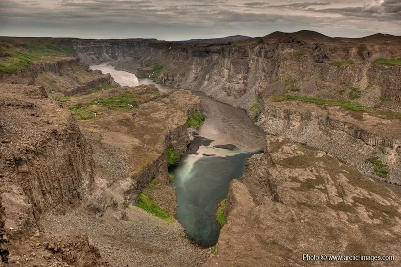
Jokulsargljufur canyon, Northern Iceland
by Ragnar Sigurdsson (arctic-images.com), Iceland
For thousands of years, Jokulsa a Fjollum, one of Iceland's largest rivers, has continued to flow from under the glacier Vatnajokull. The river has carved numerous channels into the highland bedrock and to the west of Holsfjoll it cascades from a tall rocky ledge, forming the huge waterfall Dettifoss. The canyons which take their name from the river, Jokulsargljufur, are approximately 25 km long, half a kilometre wide and in several locations they extend to a depth of over 100 metres. Higher resolution images available from rth@arctic-images.com (there is a licensing fee depending on the use).
Categories
- Field (2910)
- Geodynamics (373)
- Geomorphology (1412)
- Seismology (210)
- Stratigraphy, Sedimentology and Palaeontology (534)
- Tectonics and Structural Geology (588)
Location
- Europe (3910)
- Northern Europe (925)
- Iceland (287)
- Exact location (-16.3882 W, 65.8219 N)
Tag
Colours
Image properties
1200 × 800 px;
image/jpeg; 515.7 KB
Submitted on 10 January 2010
Licence
Creative Commons Attribution-NonCommercial-ShareAlike 3.0 Unported (CC BY-NC-SA 3.0)
Credit
Ragnar Sigurdsson (arctic-images.com) (distributed via imaggeo.egu.eu)
Share
Appreciate
Report