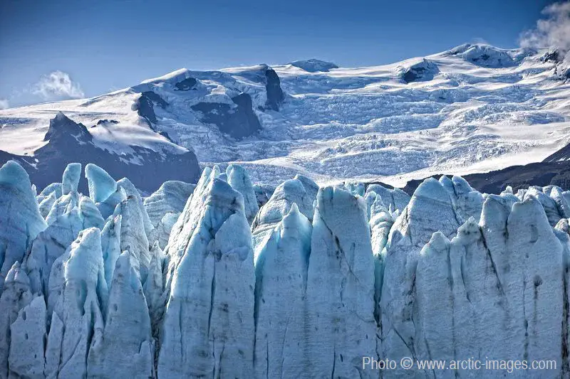
Fjallsarlon, Vatnajokull Ice Cap, Iceland
by Ragnar Sigurdsson (arctic-images.com), Iceland
Mighty and steep glaciers that adorn the eastern slopes of the Oraefajokull volcano, including Hrutar-and Fjallsjokull. The elevation difference of 2,000 metres from the top edge almost to sea level exceeds alpine proportions. They receed as most Icelandic glaciers have done during the past two decades or so. This was also the case in the period between approx. 1920 and 1970. The Fjallsjokull glacier now slides into a substantial lake in front of its steep margins, called Fjallsarlon. It is, however, much smaller than its neighbour, the grand Jokulsarlon. Ice calves from high ice cliffs. The lagoon is visited less than Jokulsarlon but worth every minute spent there. Higher resolution images available from rth@arctic-images.com (there is a licensing fee depending on the use).
Categories
- Cryospheric Sciences (728)
- Earth Magnetism & Rock Physics (352)
- Field (2911)
- Geochemistry, Mineralogy, Petrology & Volcanology (990)
Location
- Europe (3913)
- Northern Europe (925)
- Iceland (287)
- Exact location (-16.8000 W, 64.4000 N)
Tags
Colours
Image properties
800 × 533 px;
image/jpeg; 193.5 KB
Submitted on 10 January 2010
Licence
Creative Commons Attribution-NonCommercial-ShareAlike 3.0 Unported (CC BY-NC-SA 3.0)
Credit
Ragnar Sigurdsson (arctic-images.com) (distributed via imaggeo.egu.eu)
Share
Appreciate
Report