The Power of the Atlantic
by Glenn Strypsteen, KU Leuven, Bruges, Belgium
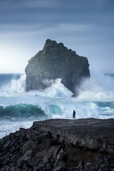
During a fierce storm that hit Reykjanes Peninsula in Iceland, with winds gusting over 130 km/h, huge waves and swell pounded the coast. The storm was caused by a low-pressure system that moved over the area, bringing with it strong winds and heavy rain.
The Reykjanes Peninsula is a region located in southwestern Iceland that is well-known for its geothermal activity, volcanic landscapes, and unique geological features. The peninsula is situated on the Mid-Atlantic Ridge, which is the boundary between the North American and Eurasian tectonic plates. As a result, the Reykjanes Peninsula is a hotbed of geological activity and an ideal location for studying various earth sciences.
I had this image on my mind for a long time, and it finally happened right before I had to leave the country. Capturing the image was challenging, as the conditions were harsh and the waves were powerful, but the resulting photograph is a testament to the beauty and power of nature.
Categories
- Geochemistry, Mineralogy, Petrology & Volcanology (990)
- Geodesy (52)
- Geodynamics (373)
- Geomorphology (1409)
- Natural Hazards (526)
- Ocean Sciences (338)
- People (320)
- Tectonics and Structural Geology (587)
Location
- Europe (3903)
- Northern Europe (925)
- Iceland (287)
- Exact location (-22.7144 W, 63.8123 N)
Colours
Image properties
3707 × 5561 px;
image/jpeg; 7.1 MB
Camera:
Nikon D750
Software: Adobe Lightroom and Photoshop
Taken on 25
September
2022
Submitted on 9 March 2023
Licence
Creative Commons Attribution-NoDerivs 3.0 Unported (CC BY-ND 3.0)
Credit
Glenn Strypsteen (distributed via imaggeo.egu.eu)
Share
Appreciate
Report