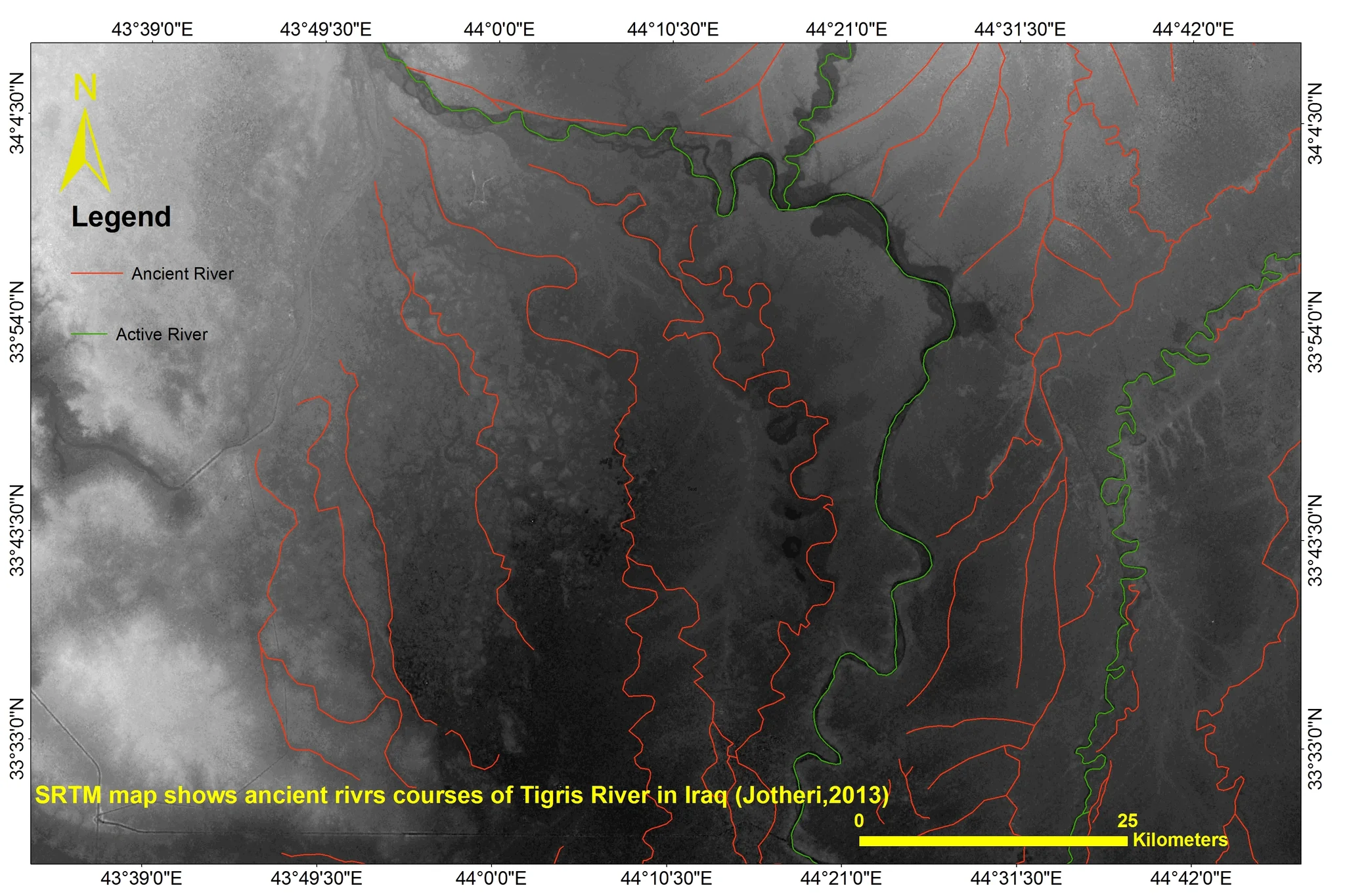
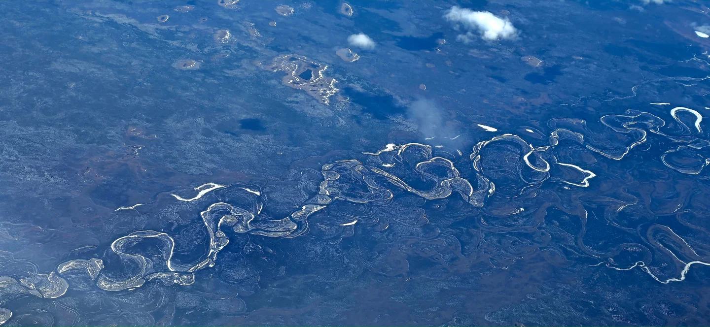
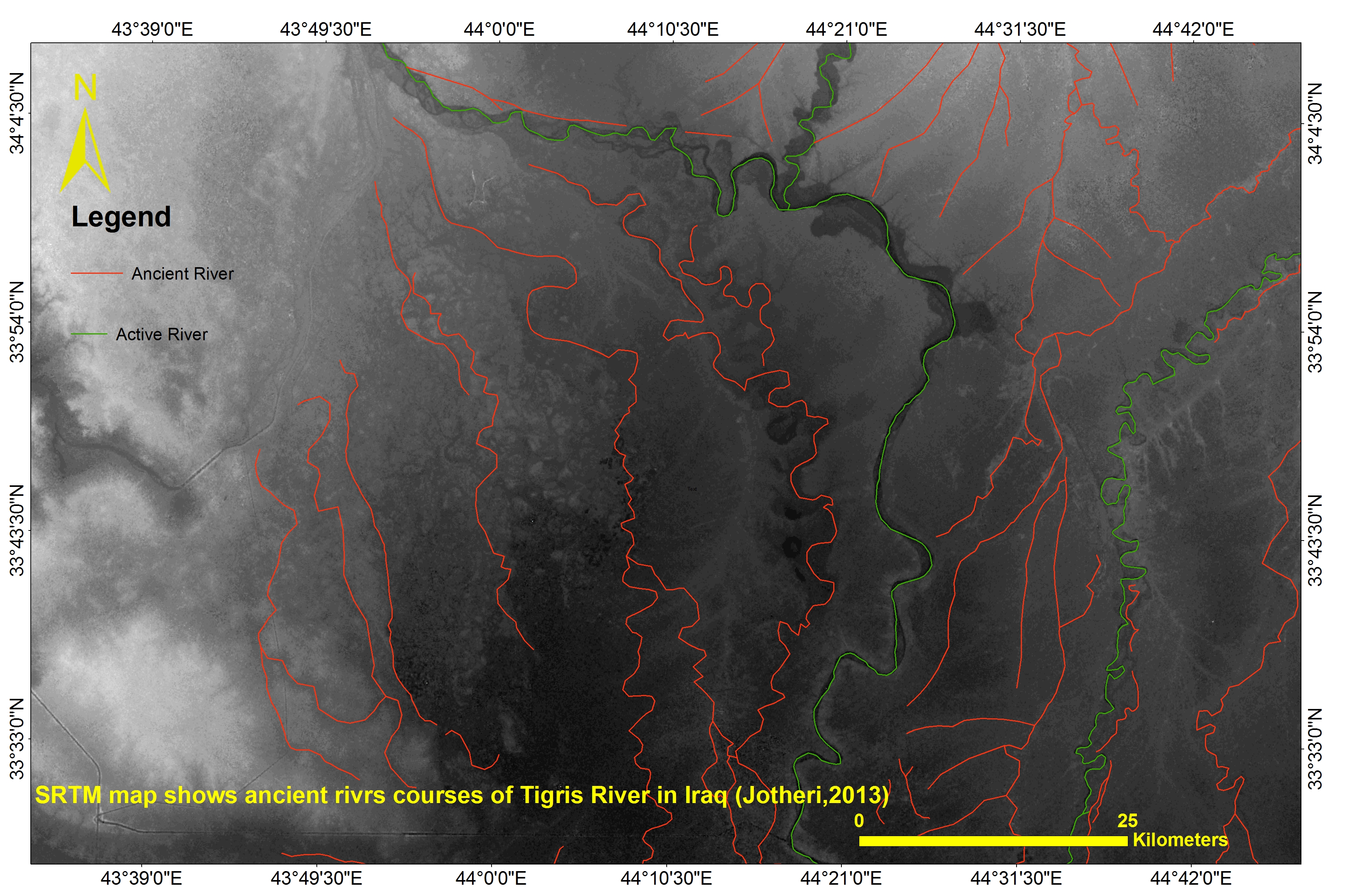
SRTM map shows ancient course of Tigris River in Iraq
This map is part of my current work in PhD in Geoarchaeology at Durham University. I am working on the ancient river in the Mesopotamian floodplain.
These rivers are subject to changes of their courses as a response to a wide range of autogenic, allogenic and human processes. Most archaeological studies which have been carried out in the Mesopotamian floodplain, have assumed that periods of active channels are closely linked to the ages of archaeological settlements and most of the identified ancient settlements were established near active channels. Therefore, the existence of settlements in certain areas is a good indication of the probability of the existence of a river close to the site and vice versa. Ages for settlements suggest the time when a particular river channel was active. During the middle to late Holocene, several cuneiform tablets have made direct reference to rivers, such as the digging of new irrigation channels, the annual cleaning of a certain river or using the river to transport goods from one city to another. These texts are useful to determine the locations and period of existence of rivers, particularly when some texts refer to identified sites. Three main courses of the Tigris, in three different periods have been identified and mapped, and summarised by time slices in this area. From oldest to the youngest, the Pleistocene course, the Holocene course and the modern course. There was no archaeological site found associated with the Pleistocene course, while so many archaeological sites have been found associated with the Holocene course ( dated from ~ 4000BC to 1200 AD). However, we have historical texts suggest that the avulsion from the Holocene course to the modern course was completed after 1258 AD and there was indication of the role of human activity as a trigger for avulsion, as farmers break the banks and dig irrigation canals to irrigate low elevation farms, and this new channel (canal) becomes the main waterway.
Featured on GeoLog, the official blog of the European Geosciences Union (opens in a new window)
Categories
Reuse
Creative Commons Attribution-ShareAlike 3.0 Unported (CC BY-SA 3.0) (opens in a new window)Credit: Jaafar Jotheri (distributed via imaggeo.egu.eu)
Comments
No comments yet. Be the first to share your thoughts.