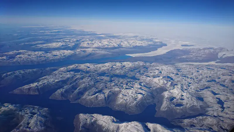
Greenland’s ice flow into the Arctic Ocean
This picture unveils the magnificence of the Sermiligaarsuk Fjord located in southwest Greenland, approximately 70km SW of Paamiut and 170km WNW of Narsarsuaq. The area is situated on the rugged West Greenland coast. Steep-sided cliffs rise to 500-900m elevation alongside the deep fjord and run for 30km to the inland ice. The landscape consists of barren plateaus and ridges and lightly vegetated valleys, with frequent ribbon-like lakes in between. There is around 75% exposure, with weathered bedrock and light scrub forming the only cover.
The climate is alpine and the weather typically very variable. I was fortunate enough to have a clear blue sky and to take this photo when my flight from Amsterdam to Boston was flighing at an altitude of 9937m above the region in October 2017.
Info source: https://www.spri.cam.ac.uk/about/funding/ginowatkins/grants/2010/sermiligaarsukfjord.pdf
Categories
- Climate: Past, Present & Future (745)
- Cryospheric Sciences (728)
- Geomorphology (1409)
- Ocean Sciences (338)
Location
- North America (772)
- Northern America (607)
- Greenland (70)
- Exact location (-48.4185 W, 61.5588 N)
Tags
Colours
Image properties
3840 × 2160 px;
image/jpeg; 3.7 MB
Camera:
Sony F8331
Taken on 11
October
2017
Submitted on 13 February 2018
Licence
Creative Commons Attribution 3.0 Unported (CC BY 3.0)
Credit
Moctar Dembélé (distributed via imaggeo.egu.eu)
Share
Appreciate
Report