Verdronken Land van Saeftinghe
by Alexis Merlaud, Belgian Institute for Space Aeronomy, Brussels, Belgium
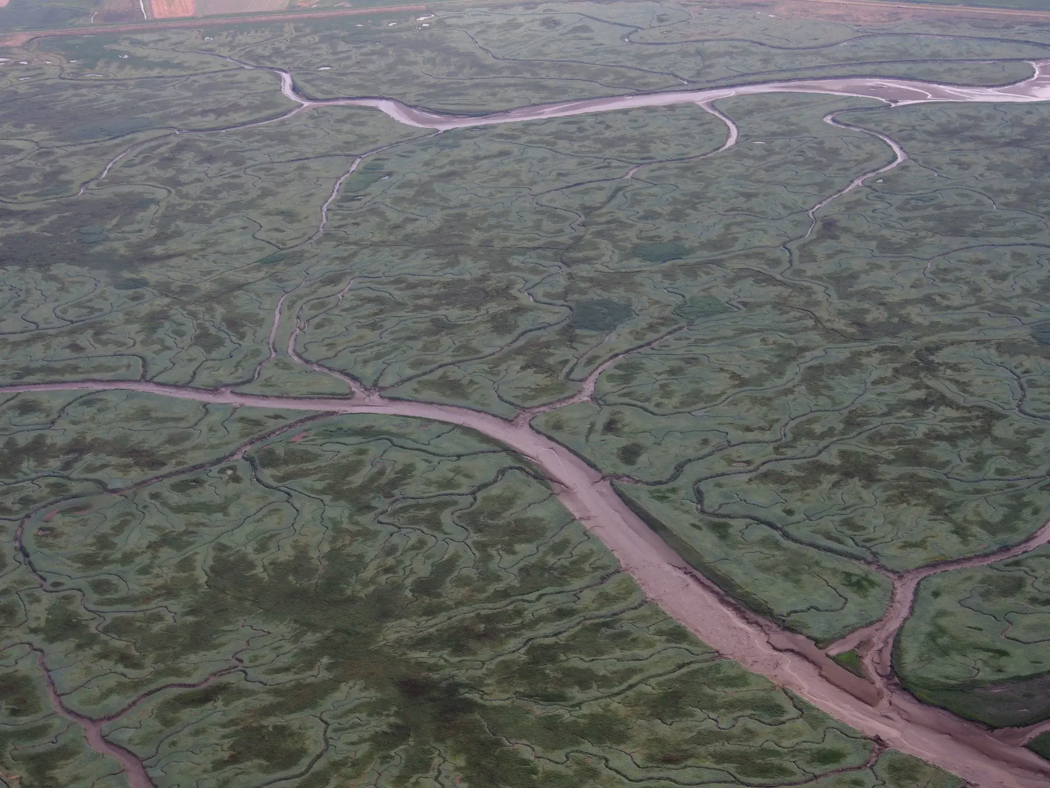
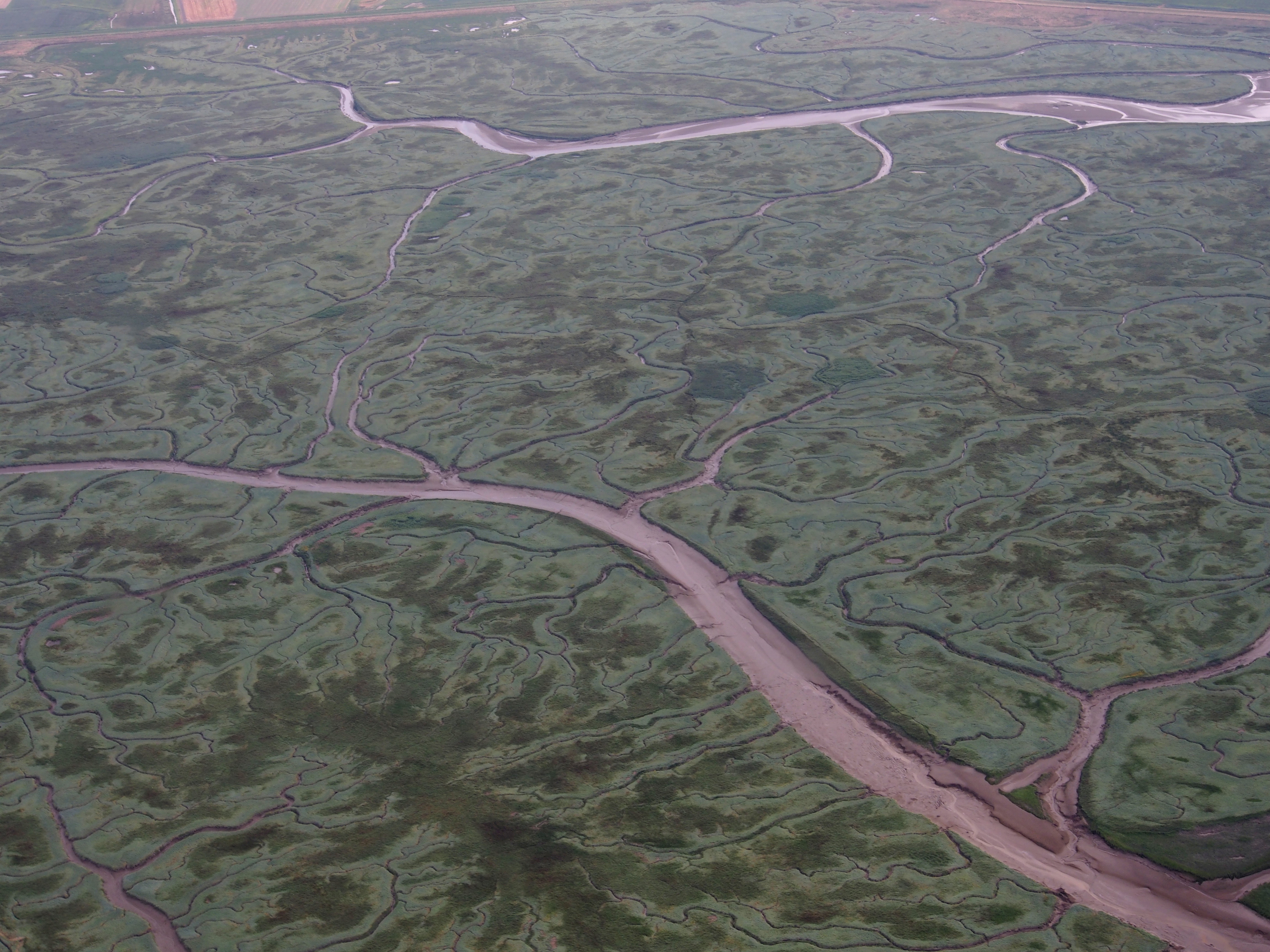
The "drowned land of Saeftinghe" is a swamp classified as a nature reserve area, on the estuary of the Scheldt river.
Picture taken during a test flight thanks to Ward Van Roy.
Category
Location
- Europe (3924)
- Western Europe (798)
- Netherlands (43)
- Exact location (4.1770 E, 51.3538 N)
Colours
Image properties
4608 × 3456 px;
image/jpeg; 8.0 MB
Camera:
Olympus E-M5
Software: Gimp
Taken on 28
July
2016
Submitted on 18 February 2017
Licence
Creative Commons Attribution 3.0 Unported (CC BY 3.0)
Credit
Alexis Merlaud (distributed via imaggeo.egu.eu)
Share
Appreciate
Report