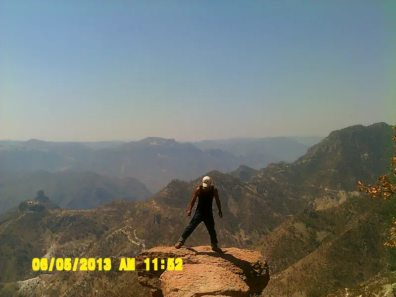
Copper Canyon, Chihuahua State, Mexico
The photo shows the grand scale of the Copper Canyon, larger and deeper than the more well known Grand Canyon in the USA, the Copper Canyon consists of 6 distinct canyon, with the rivers draining into the Gulf of California.
The Copper Canyon ecosystem has seen Mesquite and Desert Ironwood trees cut to export to the USA as charcoal. Open-pit mining of copper and gold has produced air pollution which has lead to the decline of the Tarahumara frog. Whilst damming of all the river systems has lead to water shortages in the isolated desert communities.
The Copper Canyon is home to the Tarahumara Indigenous people, who reside in the mountains during the hot summers and the lower canyon in winter. The faint, white lines on the ridges are the paths forged by the Tarahumara peope to connect tribes deep within the canyons. The Tarahumara people are also well known endurance runners, with the network of paths part one of the world's most grueling mountain marathons.
Photo taken at the Divisadero (Continental divide), about 50 km from the town of Creel. Waters to the west (in photo) drains to the Gulf of California, whilst waters to the East drains into the Gulf of Mexico.
Categories
Location
- North America (772)
- Central America (93)
- Mexico (51)
- Exact location (-107.8353 W, 27.5330 N)
Colours
Image properties
3072 × 2304 px;
image/jpeg; 1.4 MB
Camera:
Vivicam
Taken on 5
June
2013
Submitted on 8 February 2016
Licence
Creative Commons Attribution 3.0 Unported (CC BY 3.0)
Credit
David Heptinstall (distributed via imaggeo.egu.eu)
Share
Appreciate
Report