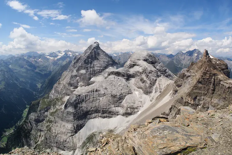
The Pflersch Valley
by Martin Reiser, University of Innsbruck, Innsbruck, Austria
The view from the peak of the Rosslauf towards the prominent peak of the Pflerscher Tribulaun (3097 m a.s.l.). The peaks are located on the main ridge of the Alps, which also represents the border between Austria and Italy. The brown and grey rocks in the foreground (dolomites and calcite marbles) represent the parautochthonous Mesozoic cover of the Austroalpine Ötztal-Stubai basement. The latter builds up the peaks in the background. The valley on the left is the Pflersch Valley (ital. Val di Fleres) on the Italian side of the border.
Categories
- Field (2910)
- Geomorphology (1412)
- Stratigraphy, Sedimentology and Palaeontology (534)
- Tectonics and Structural Geology (588)
Location
- Europe (3910)
- Western Europe (796)
- Austria (142)
- Exact location (11.3655 E, 46.9863 N)
Tags
- mountains (131)
- alps (101)
- geology (75)
- italy (42)
- view (11)
- tyrol (2)
- mesozoic (3)
- regional (1)
- austria (8)
- austroalpine (1)
- tribulaun (1)
- pflersch (1)
Colours
Image properties
3681 × 2454 px;
image/jpeg; 5.9 MB
Camera:
Olympus E-M5
Taken on 18
August
2013
Submitted on 1 March 2015
Licence
Creative Commons Attribution-NonCommercial-NoDerivs 3.0 Unported (CC BY-NC-ND 3.0)
Credit
Martin Reiser (distributed via imaggeo.egu.eu)
Share
Appreciate
Report