Into the Depths
by John Clemens
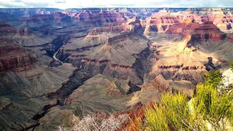
From this vantage point on the South Rim of the Grand Canyon in Arizona, the Colorado River can be seen grinding its way down through the tough Early Proterozoic Vishnu Schist, with linear side canyons controlled mainly by various faults. Unconformably overlying this is the thin, tilted and slightly recrystallised, Late Proterozoic Grand Canyon Supergroup. In a subtle (in this locality) angular unconformity this is all overlain by the subhorizontal sequences of softer sedimentary rocks that take us through from the Cambrian to the Late Permian. From here down to the river is a vertical drop of 1600 m. The erosion (river, wind, frost and mass wasting) has carved the Canyon into these strangely shaped narrow ridges and triangular "monuments".
Categories
Location
- North America (772)
- Northern America (607)
- United States of America (403)
- Exact location (-112.0882 W, 36.0587 N)
Tags
Colours
Image properties
3648 × 2056 px;
image/jpeg; 8.9 MB
Camera:
Fujifilm FinePix HS10 HS11
Taken on 8
April
2013
Submitted on 5 February 2014
Licence
Creative Commons Attribution-NonCommercial-NoDerivs 3.0 Unported (CC BY-NC-ND 3.0)
Credit
John Clemens (distributed via imaggeo.egu.eu)
Share
Appreciate
Report