Polarcat As0831
by Alexis Merlaud, Belgian Institute for Space Aeronomy, Brussels, Belgium
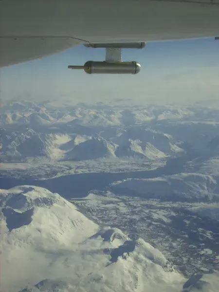
Picture taken in the North Cape area during the flight as0831 of the POLARCAT Spring campaign (April 2008), from the Safire ATR-42 scientific aircraft. POLARCAT's main scientific goal was the quantification of pollution from mid-latitude to the Arctic. The canister under the wing is the particle measuring system for aerosols. Our own DOAS instrument was measuring aerosol extinction and NO2 and is described in Merlaud et al. Airborne DOAS measurements in Arctic: vertical distributions of aerosol extinction coefficient and NO2 concentration, ACP, 2011 (doi:10.5194/acp-11-9219-2011).
Thanks to Caroline Fayt and Fabien Darrouzet.
Categories
Location
- Europe (3907)
- Northern Europe (925)
- Norway (161)
- Exact location (26.2335 E, 70.9361 N)
Colours
Image properties
480 × 640 px;
image/jpeg; 196.2 KB
Camera:
Pentax Image
Taken on 8
April
2008
Submitted on 4 December 2013
Licence
Creative Commons Attribution-NonCommercial-ShareAlike 3.0 Unported (CC BY-NC-SA 3.0)
Credit
Alexis Merlaud (distributed via imaggeo.egu.eu)
Share
Appreciate
Report