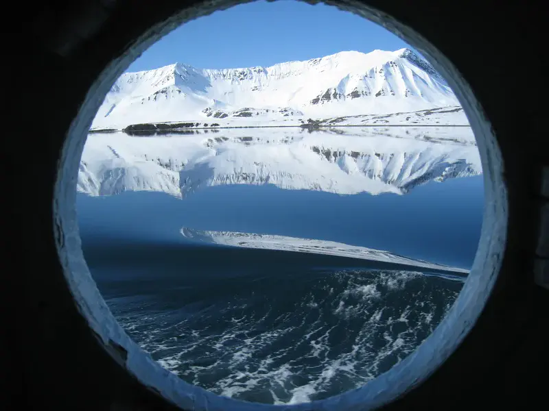
Arctic through a porthole
by Fabien Darrouzet, Belgian Institute for Space Aeronomy (BIRA-IASB), Brussels, Belgium
This picture was taken in Svalbard (78 lat.) in June 2012. I was there for one week in order to observe the transit of the planet Venus in front of the Sun. I came here because at this time of the year, the Sun is shining all day (midnight Sun), so it was possible to see Venus during most of the transit (for over six and a half hours!), and not only during its last minutes, as was the case for most parts of Europe.
During the days before the transit, I made a boat trip inside the fjords around Longyearbyen, and in particular in the Isfjorden, where I took this picture through the porthole of the boat. This is the southern border of a territory of Svalbard named Oscar II Land. This area, and indeed all of Svalbard, is covered by snow most of the time, and just a few plants can germinate during July-August, when the average temperature is 5 C.
Svalbard is a very important island and region because it is dominated by glaciers (60% of all the surface), which are important indicators of global warming and can reveal possible answers as to what the climate was like up to several hundred thousand years ago. Those glaciers are studied and analysed by scientists in order to better observe and understand the consequences of the global warming on our Earth.
Published on the EGU blog on 6 May 2013: http://geolog.egu.eu/2013/05/06/imaggeo-on-mondays-spying-on-the-arctic/
Featured on GeoLog, the official blog of the European Geosciences Union
Categories
Location
- Europe (3915)
- Northern Europe (925)
- Norway (161)
- Exact location (15.6500 E, 78.2200 N)
Colours
Image properties
2048 × 1536 px;
image/jpeg; 643.0 KB
Camera:
Canon IXUS 860 IS
Taken on 6
June
2012
Submitted on 4 March 2013
Licence
Creative Commons Attribution-NonCommercial-NoDerivs 3.0 Unported (CC BY-NC-ND 3.0)
Credit
Fabien Darrouzet (distributed via imaggeo.egu.eu)
Share
Appreciate
Report