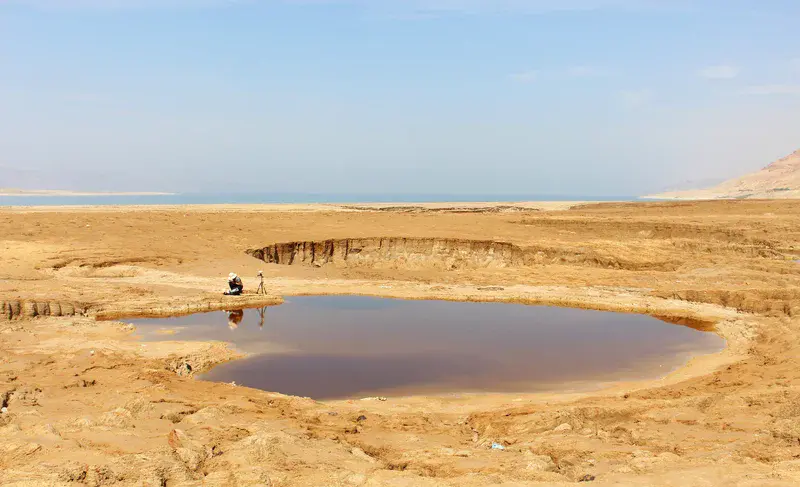
A study of sinkholes in the former bed of the Dead Sea, Jordan.
The Dead Sea is the lowest point on the continents on Earth (-434 m) and is becoming lower still, by about 1 m per year. One consequence is the appearance of over 3000 sinkholes around the Dead Sea shore in the last 35 years. This image shows a relatively small, ca. 10 m diameter, ca. 1 m deep sinkhole that developed in interbedded mud and salt deposits. The current shoreline of the Dead Sea is visible in the background. The shoreline has retreated by over 1 km since 1990 to reveal this landscape. Scientists working within the Dead Sea Research Venue (DESERVE), a Helmholtz Virtual Institute, are here measuring the water level with GPS and quantifying the temperature and electrical conductivity with a digital multimeter. They are also collecting samples for isotope analysis. The goal is to characterise the hydrological conditions driving sinkhole formation here and so to better understand the underlying processes.
Categories
Location
- Asia (1142)
- Western Asia (318)
- Jordan (54)
- Exact location (35.5396 E, 31.3210 N)
Tags
Colours
Image properties
5165 × 3145 px;
image/jpeg; 9.3 MB
Camera:
Canon EOS 700D
Taken on 22
October
2015
Submitted on 15 February 2018
Licence
Creative Commons Attribution 3.0 Unported (CC BY 3.0)
Credit
Eoghan Holohan (distributed via imaggeo.egu.eu)
Share
Appreciate
Report