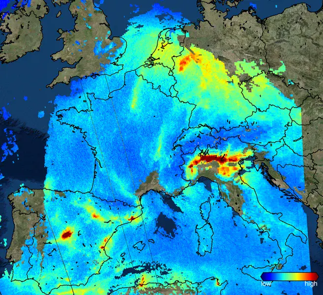
A new view on air quality from space
On 13 October 2017 the Copernicus Sentinel 5 Precursor satellite was launched. The image shows one of the first results from the TROPOMI instrument, a map of nitrogen dioxide concentrations over Europe in on 22 November 2017. In cases of of clouds the image shows an RGB map of the world. Nitrogen dioxide (NO2) is an important gas for air quality and is produced by a.o. power plants, traffic and industry. The TROPOMI instrument improves the spatial resolution by a factor of 10 compared to previous satellite missions.
Category
Location
Colours
Image properties
2421 × 2212 px;
image/png; 4.4 MB
Camera:
Airbus TROPOMI
Taken on 22
November
2017
Submitted on 9 February 2018
Licence
Creative Commons Attribution 3.0 Unported (CC BY 3.0)
Credit
Pepijn Veefkind (distributed via imaggeo.egu.eu)
Share
Appreciate
Report