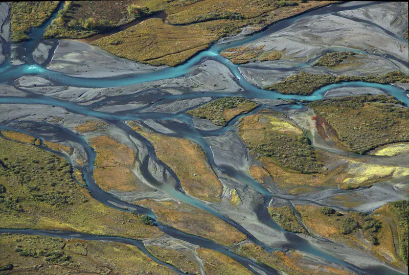
Rahpaädno river seen from the Ladebakte mountain
by Jakob Keck, Germany
The view of the southern edge of the Ladebakte mountain in the Sarek national park in north Sweden. At this place the rivers Rahpajaka and Sarvesjaka meet to form the biggest river of the Sarek national park, the Rahpaädno. The rivers are fed by glaciers and carry a lot of rock material which lead to a distinct sedimentation and a fascinating river delta for which the Sarek park laying west of the Kungsleden hiking trail is famous.
As the borders of this picture are not straight (due to lens-correction in GIMP) an edited version has been uploaded.
Featured on GeoLog, the official blog of the European Geosciences Union
Categories
Location
- Europe (3901)
- Northern Europe (925)
- Sweden (80)
- Exact location (17.7377 E, 67.2730 N)
Tags
Colours
Image properties
4729 × 3182 px;
image/jpeg; 19.4 MB
Camera:
Canon EOS 500D
Software: GIMP
Taken on 4
September
2017
Submitted on 29 December 2017
Licence
Creative Commons Attribution-ShareAlike 3.0 Unported (CC BY-SA 3.0)
Credit
Jakob Keck (distributed via imaggeo.egu.eu)
Share
Appreciate
Report